How to Enable and Use Aerial View on Tapo Doorbells
Neuere Updates können den Zugang zu Funktionen, die in dieser FAQ erläutert werden, erweitert haben. Besuchen Sie die Support-Seite Ihres Produkts, wählen Sie die richtige Hardware-Version für Ihr Gerät aus und schauen Sie entweder im Datenblatt oder im Firmware-Bereich nach den neuesten Verbesserungen für Ihr Produkt.
Aerial View is a radar-powered feature that helps you visualize visitor movement around your home using a bird's-eye map. This guide explains how Aerial View works, how to configure it in the Tapo app, and what to do if tracking results are missing or inaccurate.
Note: Aerial View is currently available only on the Tapo D260.
Key Takeaways
- Aerial View uses radar to create a top-down tracking path of visitors around your property.
- Visitor movement is displayed as real-time, color-coded tracking dots on a map overlay.
- Aerial View setup requires configuring the doorbell's location, orientation, and radar settings in the Tapo app.
- Aerial View is designed for human tracking and does not generate paths for pets, vehicles, or other moving objects.
- Accurate tracking depends on correct installation height, location placement, and viewing direction settings.
What Is Aerial View
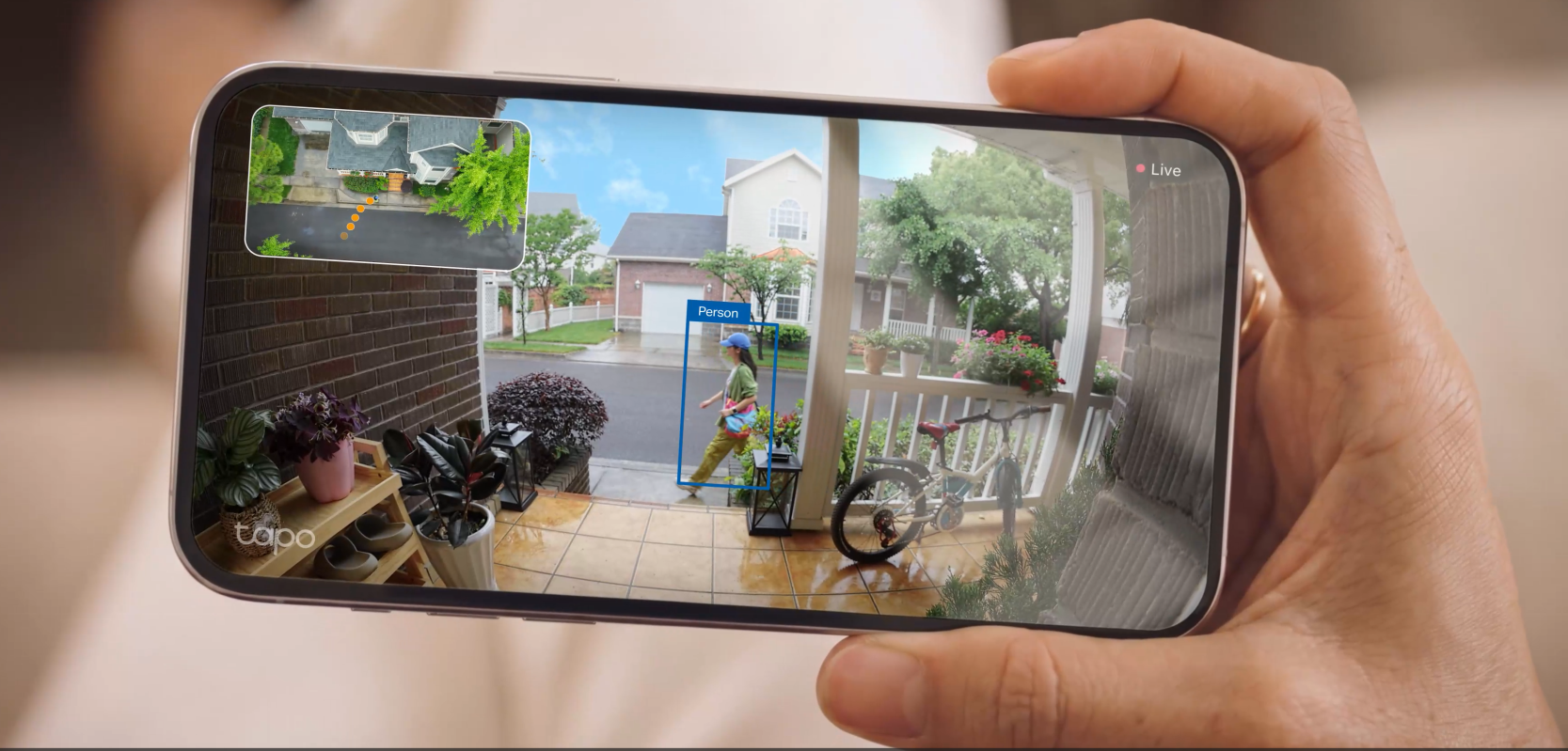
Aerial View uses radar technology to track and display a visitor's movement path from an overhead perspective. It helps you determine whether someone approached your door or simply passed by.
When Aerial View is enabled and the radar detects a person, a picture-in-picture (PiP) window appears in Live View; detected targets are shown as orange dots. As a person moves, the dots update in real time while previous positions gradually fade, creating a visual movement trail.
For optimal performance, use Aerial View in open areas, as radar cannot detect movement through walls or other solid objects.
Note: The screenshots and app interface shown below are for reference only.
How to Enable Aerial View
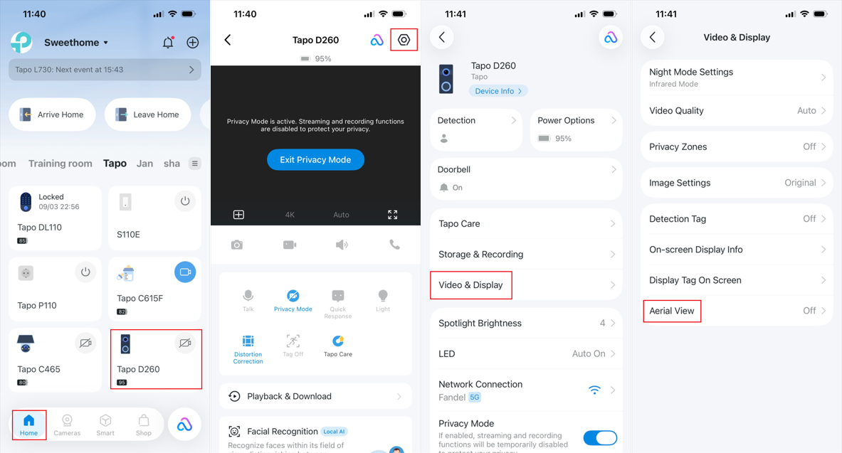
Step 1. Open the Tapo app Home page, tap your doorbell device card to enter Live View.
Step 2. Tap the gear icon in the top right corner to enter Device Settings, select Video & Display > Aerial View to turn the feature on.
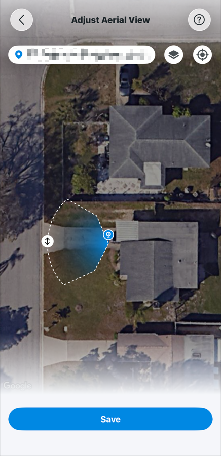
Step 3. Tap Set Up View and follow the on-screen instructions to configure the doorbell’s location and facing direction.
- Grant location permission to the Tapo App, or manually enter your address.
- Press and hold the location pin, then drag it to the doorbell’s installation location.
- Adjust the direction angle to match the doorbell’s actual viewing angle.
- Tap Save.
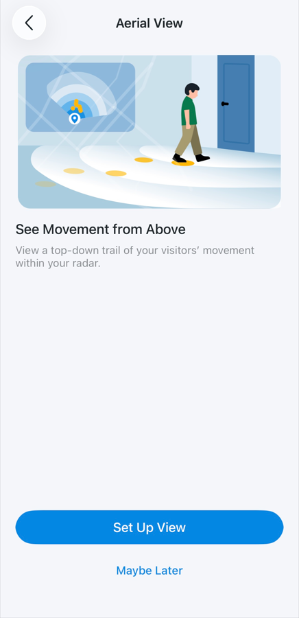
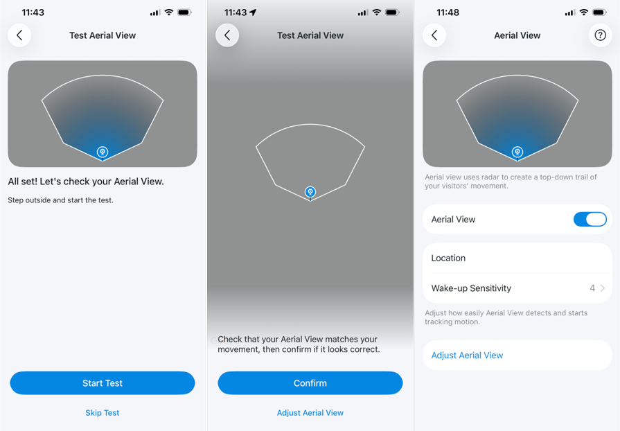
Step 4. Tap Start Test and walk through the monitored area to verify the setup. If the displayed movement path matches your actual movement, tap Confirm to complete the setup.
Step 5. Afterward, you can adjust Wake-up Sensitivity to control how easily the radar detects and starts tracking movement.
Note: Wake-up sensitivity here also applies to PIR and radar-based motion detection.
Q&A
Q1: What can I do if Aerial View is not working or is missing for certain events?
Please check the following:
- Make sure Aerial View is enabled in the Tapo App > Doorbell Device Settings > Video & Display.
- Grant Precise Location permission to the Tapo app on your phone or tablet.
- Aerial View is designed specifically for human tracking. It does not generate movement paths for vehicles, pets, or other moving objects such as trees swaying in the wind.
- Test whether the radar sensor is functioning properly by walking directly in front of the doorbell. If the radar fails to wake up the doorbell or trigger a motion detection notification, the radar hardware may be damaged.
Q2: The tracking dots on the Aerial View map appear inaccurate. How can I improve accuracy?
Aerial View accuracy depends heavily on the doorbell's installation height and setup.
For Tapo D260, the recommended installation height is 1.2 m (±20 cm) above the ground. Installing the doorbell significantly higher or lower than this height can affect the distance calculations between the target and doorbell, resulting in inaccurate target positions on the Aerial View map.
If you notice tracking inaccuracies, verify that:
- The doorbell is installed within the recommended height range.
- The doorbell location pin is placed correctly during Aerial View setup.
- The configured facing direction matches the doorbell's actual orientation.
- The Tapo app has Precise Location permission enabled.
After making adjustments, run Aerial View Test again to recalibrate and verify tracking accuracy.
To learn more about each function and configuration, please visit the Download Center to download the manual for your product.